


HARRISON TWP Voting District, Lee County, Iowa
About
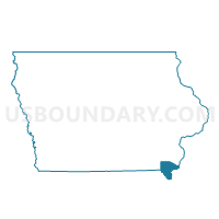
Outline

Summary
| Unique Area Identifier | 582598 |
| Name | HARRISON TWP Voting District |
| County | Lee County |
| State | Iowa |
| Area (square miles) | 36.53 |
| Land Area (square miles) | 36.51 |
| Water Area (square miles) | 0.02 |
| % of Land Area | 99.95 |
| % of Water Area | 0.05 |
| Latitude of the Internal Point | 40.67653140 |
| Longtitude of the Internal Point | -91.65634850 |
Maps


Graphs
Select a template below for downloading or customizing gragh for HARRISON TWP Voting District, Lee County, Iowa


Neighbors
Neighoring Voting District (by Name) Neighboring Voting District on the Map
- BONAPARTE TWP Voting District, Van Buren County, IA
- CEDAR TWP W/O HOUGHTON Voting District, Lee County, IA
- CHARLESTON TWP W/O DONNELLSON Voting District, Lee County, IA
- FARMINGTON TWP Voting District, Van Buren County, IA
- FRANKLIN TWP W/O DONNELLSON Voting District, Lee County, IA
- HARRISBURG Voting District, Van Buren County, IA
- MARION TWP W/O HOUGHTON Voting District, Lee County, IA
- VAN BUREN TWP Voting District, Lee County, IA
Top 10 Neighboring County Subdivision (by Population) Neighboring County Subdivision on the Map
- Franklin township, Lee County, IA (1,369)
- Farmington township, Van Buren County, IA (898)
- Charleston township, Lee County, IA (733)
- Bonaparte township, Van Buren County, IA (631)
- Marion township, Lee County, IA (509)
- Cedar township, Lee County, IA (376)
- Harrison township, Lee County, IA (368)
- Van Buren township, Lee County, IA (351)
- Harrisburg township, Van Buren County, IA (343)
Top 10 Neighboring Unified School District (by Population) Neighboring Unified School District on the Map
- Fort Madison Community School District, IA (17,311)
- Central Lee Community School District, IA (5,363)
- Harmony Community School District, IA (2,580)
Top 10 Neighboring State Legislative District Lower Chamber (by Population) Neighboring State Legislative District Lower Chamber on the Map
- State House District 90, IA (28,496)
- State House District 92, IA (28,301)
- State House District 91, IA (27,706)
Top 10 Neighboring State Legislative District Upper Chamber (by Population) Neighboring State Legislative District Upper Chamber on the Map
Top 10 Neighboring 111th Congressional District (by Population) Neighboring 111th Congressional District on the Map
Top 10 Neighboring Census Tract (by Population) Neighboring Census Tract on the Map
- Census Tract 9501, Van Buren County, IA (4,209)
- Census Tract 4905, Lee County, IA (3,594)
- Census Tract 9502, Van Buren County, IA (3,361)
- Census Tract 4904, Lee County, IA (2,823)